Spotting land potential
Full-coverage assessment instead of a listings sheet: locations with no active listing become visible too, along with their development indicators.
Dagnext.ai scores every location in North Rhine-Westphalia against criteria you weight yourself. You get a comparable ranking instead of an opinion — with sub-scores you can trace.
Real-estate and urban-development decisions still rest largely on intuition, on fragmented reports and on outdated static data. That brittle basis is what makes critical mistakes possible.
Plots are chosen subjectively, often based on the local experience of individual people.
Valuation reports, market data and location information sit side by side without a shared assessment logic.
Long and costly preliminary checks — and with banks and investors, the location stays a matter of assertion.
North Rhine-Westphalia is divided completely into 135,000 hexagons of 0.25 km² each. Every unit is scored against more than 350 indicators, weighted by criteria you set yourself.
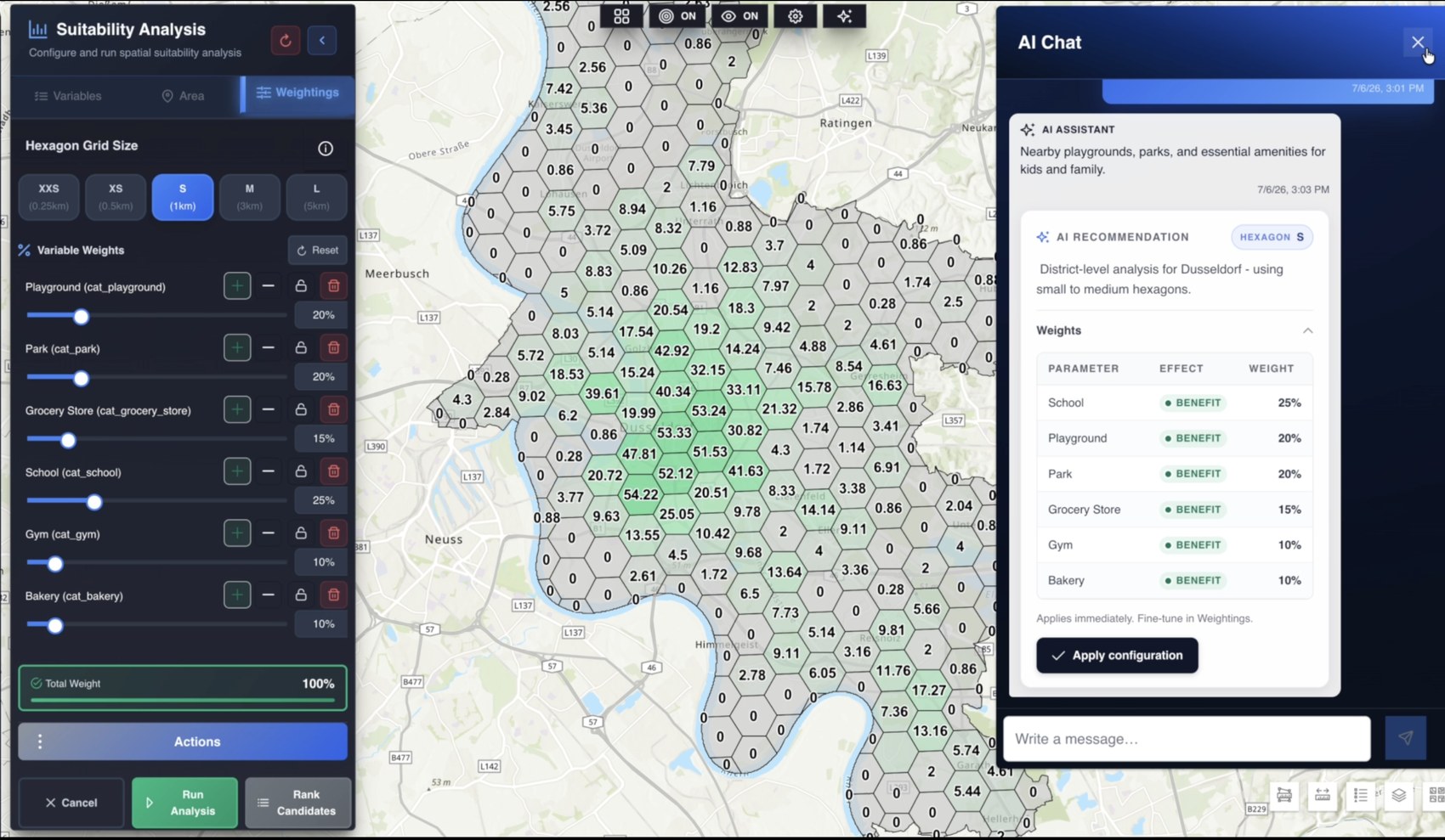
Regional analysis and comparison at macro level.
Deep data layers at micro-location level.
A clear score and an analysis report at enterprise standard.
Take the results further as PDF, Excel, CSV or KMZ.
The overall score can be opened down to the individual category. So it stays clear where an advantage comes from and where a location is weak.
The same area can be scored again with different priorities, without using further credit. That comparison is exactly the heart of the method.
Because every assessment unit is the same size, cities and regions are directly comparable. Administrative boundaries do not distort the result.
Reports at enterprise standard speed up financing processes and make the location assessment defensible in front of committees.
Full-coverage assessment instead of a listings sheet: locations with no active listing become visible too, along with their development indicators.
Set several offers in different cities against each other under a single assessment logic.
Collateral analysis in the lending process and data-based regional prioritisation in urban development.
Tell us a region or a portfolio and the criteria that matter to you. We go through the result together with you — on your own market.